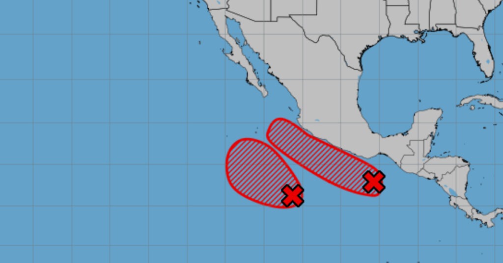

A rare cold front and low-pressure channel bring heavy rain, lightning, hail and flooding to northeastern and central Mexico, while a sprawling heat wave bakes the rest of the country.
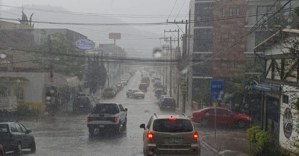
A rare out-of-season cold front moving into Mexico’s northern border has collided with a persistent dry line and the subtropical jet stream, unleashing intense thunderstorms, gusty winds and hail from Nuevo León through San Luis Potosí. At the same time, a broad low-pressure channel tapping moisture from both the Pacific and the Gulf of Mexico is fueling heavy downpours and electrical storms across the west, center, east and southeast. Despite these wet systems, an expansive mid-level anticyclone is baking much of the country under a pronounced heat wave.
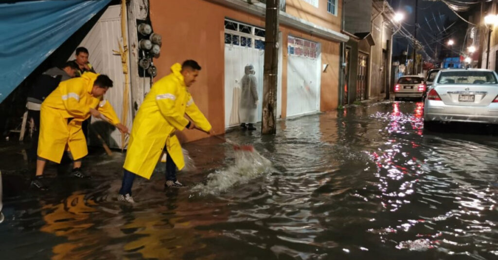
Officials warn that 75–150 mm of rain may fall today over Nuevo León, Tamaulipas and San Luis Potosí, where flooding, mudslides and landslides pose a serious threat. Intense rainfall of 50–75 mm is forecast for Querétaro and Hidalgo, while heavy showers (25–50 mm) will drench southeastern Coahuila, Guanajuato, the State of Mexico, Tlaxcala, Puebla and Chiapas. Lighter intervals of rain (5–25 mm) are expected in Zacatecas, Aguascalientes, Jalisco, Michoacán, Mexico City, Morelos, Oaxaca and Veracruz, with isolated drizzles elsewhere along the Pacific coast.
Meanwhile, thermometers are set to soar. Afternoon highs between 40 °C and 45 °C will blister large swaths of Sonora, Sinaloa, Nayarit, Jalisco, Michoacán, Guerrero, Morelos, Oaxaca, northern Chiapas, southwestern Chihuahua, Coahuila, northeastern Nuevo León, Tamaulipas, San Luis Potosí, southern Zacatecas, northwestern Durango, northern Querétaro and Hidalgo, parts of Puebla, Veracruz, Tabasco, Campeche and Yucatán. Another belt of very hot conditions—35 °C to 40 °C—will grip Baja California, Baja California Sur, Aguascalientes, Colima, Guanajuato, southwestern State of Mexico and Quintana Roo, while Mexico City and Tlaxcala peak at 30 °C–35 °C.
Overnight lows dipped below freezing in the high mountains of Durango (−5 °C to 0 °C) and hover near 0 °C to 5 °C across Chihuahua’s highlands. These cold pockets contrast sharply with the blazing daytime heat on the plains.
Gusty winds—up to 70 km/h—are forecast along the coasts of Veracruz and the Isthmus of Tehuantepec, and across Nuevo León, San Luis Potosí, Tamaulipas, Campeche, Yucatán and Quintana Roo. Dust storms will be possible in Coahuila, Querétaro, Hidalgo and several interior states, raising health and visibility concerns. Strong to very strong gusts may topple trees and billboards, while intensified winds amid hot, dry conditions could fan wildfires across Sonora, Sinaloa, Durango, Nayarit, Colima, Jalisco, Michoacán, Guerrero, Oaxaca, Chiapas, Chihuahua, Coahuila, Nuevo León, Tamaulipas, Querétaro, Hidalgo, the Valley of Mexico, Puebla and Quintana Roo.
Offshore, wave heights of 1.5–2.5 m are expected along the western coast of Baja California and the Pacific shores of Jalisco, Colima, Michoacán, Guerrero, Oaxaca, Chiapas and Tamaulipas.
Regional Outlook
- Valley of Mexico: Morning fog gives way to mild conditions in Mexico City (min. 13–15 °C, max. 30–32 °C) and cold highs of 7–9 °C in Toluca. Afternoon will be hot, with heavy showers and thunderstorms—possibly hail—in the State of Mexico and dainty showers over the capital. Variable winds at 10–20 km/h, gusting to 50 km/h.
- Baja California Peninsula: Partly cloudy and rain-free, with morning fog on the western coast. Temperatures range from cool in the morning to hot by afternoon. Northwest winds 10–20 km/h, gusting to 50 km/h; 1.5–2.5 m waves off Baja California.
- North Pacific (Sonora & Sinaloa): Morning chill and highland frost; afternoon heat wave in central and southern Sinaloa. West-southwest winds 10–20 km/h, gusting to 50 km/h, with dust storms likely.
- Central Pacific (Nayarit, Jalisco, Colima, Michoacán): Morning fog and cool temps; afternoon clouds with isolated storms in Jalisco and Michoacán, none in Nayarit. Heat wave persists in Nayarit, Jalisco, eastern Colima and Michoacán. Southwest winds 10–20 km/h, gusting to 50 km/h, with possible dust. 1.5–2.5 m waves along coasts.
- South Pacific (Guerrero, Oaxaca, Chiapas): Early fog; heavy rains in Chiapas with flood and landslide risk. Showers in Oaxaca and isolated rain in Guerrero, with thunder and hail possible. Afternoon heat wave in Guerrero, Oaxaca and northern Chiapas. Variable winds 10–30 km/h, gusting to 70 km/h at the Isthmus; 1.5–2.5 m coastal waves.
- Gulf of Mexico (Tamaulipas, Veracruz, Tabasco): Morning fog in Veracruz highlands and Tamaulipas coast. Heavy rains in Tamaulipas (landslide and flood risk); thunderstorms and hail in Veracruz; dry in Tabasco. Afternoon heat wave across the region. South winds 20–30 km/h, gusting to 70 km/h; 1.5–2.5 m waves off Tamaulipas.
- Yucatán Peninsula: Clear morning, partly cloudy afternoon with no rain. Afternoon heat wave over southwestern Campeche and Yucatán. Southeast winds 20–30 km/h, gusting to 60 km/h.
- Mesa del Norte (Northern Plateau): Morning fog in Durango; otherwise dry in Chihuahua and Durango. Intense rains in Nuevo León and San Luis Potosí; heavy in Coahuila; showers with lightning and hail in Zacatecas and Aguascalientes. Afternoon heat wave across the highlands. Winds 20–30 km/h, gusting up to 70 km/h; dust devils expected.
- Central Plateau: Morning chill, rising clouds later. Very heavy storms in Querétaro and Hidalgo; heavy rain in Guanajuato, Puebla and Tlaxcala (landslide risk); showers in Morelos. Possible hail. Afternoon heat wave from Guanajuato through Hidalgo and Tlaxcala. Winds 20–30 km/h, gusting to 60 km/h; dust storms possible.
Recent Extremes
In the past 24 hours, Chiconautla (Edomex) recorded 15.0 mm of rain, Tacaná Volcano 13.0 mm and Gustavo A. Madero (CDMX) 10.0 mm. Highs reached 44.0 °C in Monclova (Coahuila), 43.0 °C in Matlapa (Hidalgo) and 42.9 °C in Ciudad Victoria (Tamaulipas). Overnight lows bottomed out at 4.8 °C in Temósachic (Chihuahua) and 9.6 °C in Toluca.
What You Should Do
Residents in the northeast and central highlands should stay alert for flash flooding and avoid travel on landslide-prone routes. Secure loose items outdoors to prevent wind-blown damage, and heed advisories on wildfire risk in parched, gusty regions. Keep emergency kits at hand in areas under heat-wave alerts, and check on vulnerable neighbors during both extreme heat and severe storms.