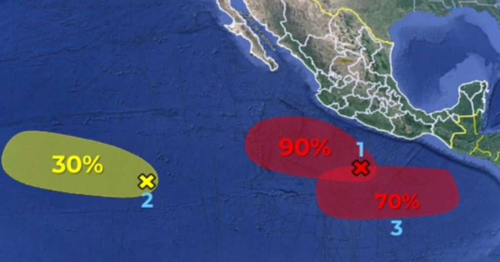
On Tuesday, the National Meteorological Service (SMN) announced the monitoring of three areas in the Pacific Ocean with the potential to develop into tropical cyclones. These areas, currently under observation, could evolve into significant weather phenomena that may impact the Mexican coast.
The SMN, responsible for providing crucial meteorological information, has highlighted regions with high probabilities for cyclonic development and issued relevant forecasts. Their vigilant monitoring is essential for preparing and informing coastal communities about potential weather threats.
One of the monitored areas is a low-pressure zone situated south of Guerrero and Michoacán, associated with tropical wave number 14. This area has shown a substantial increase in the likelihood of cyclonic development, now at 90% over the next 48 hours, and it is expected to maintain this high probability for the next seven days. Currently, it is located approximately 520 kilometers southwest of Acapulco, Guerrero, and is moving west-northwest at a speed of 16 to 24 kilometers per hour.
Additionally, the SMN forecasts the formation of a new low-pressure zone south of Chiapas, Oaxaca, and Guerrero. This zone has a 70% probability of cyclonic development within the next seven days. The SMN’s continuous monitoring of these areas is crucial for providing timely warnings and preparing the affected regions for potential weather disruptions.
The SMN’s role in forecasting and tracking tropical cyclones is vital for the safety and preparedness of coastal communities in Mexico. As these potential cyclones develop, the SMN will continue to provide updates and necessary precautions to ensure the safety and well-being of the public.
