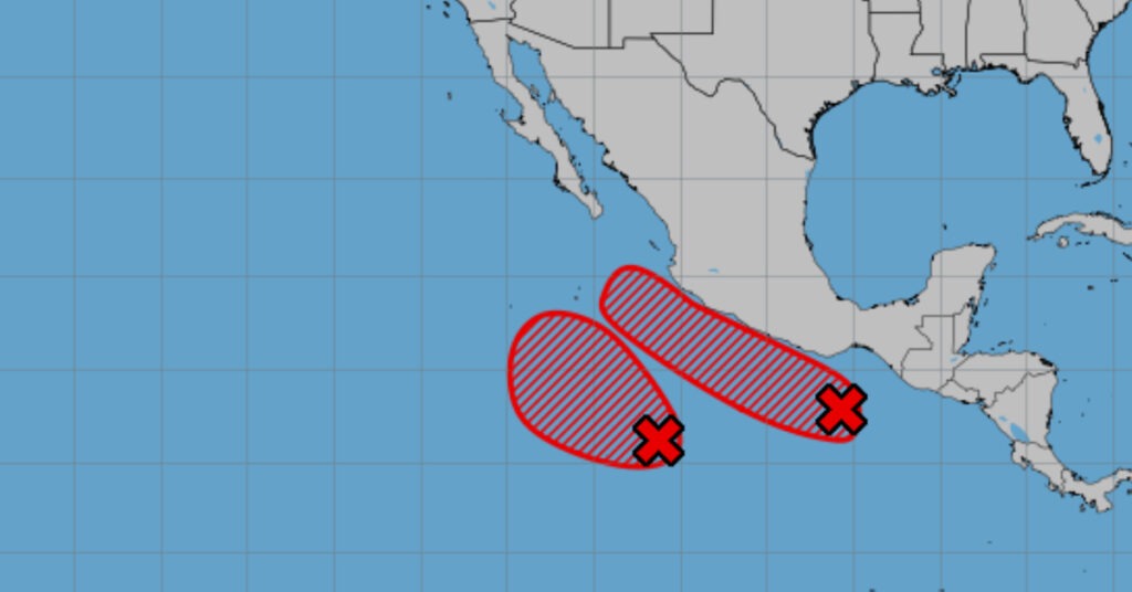

Tropical Cyclone One-E intensifies parallel to the coasts of Michoacán, Colima and Jalisco, triggering heavy rain, strong winds and high waves across western and southern Mexico.
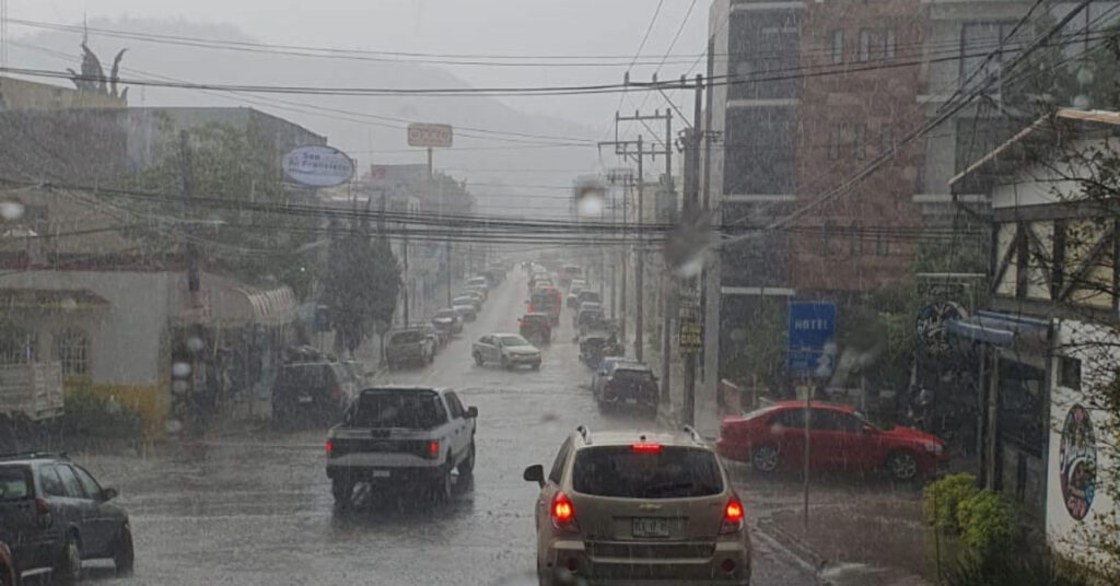
Tropical Cyclone One-E intensifies as it moves parallel to the coasts of Michoacán, Colima and Jalisco. The storm’s expanding cloud bands will fuel rain and showers in Mexico’s northwest, west and south. Guerrero faces very heavy rainfall, while Jalisco, Colima and Michoacán will see heavy downpours. Wind gusts may reach 50–70 km/h along those coasts, and waves could top 3 meters.
Low-pressure channels over northern, central and southeastern Mexico will tap into moisture from the Gulf of Mexico, Pacific Ocean and Caribbean Sea. The resulting instability will spark showers and heavy rains there and spill into northeastern and eastern states. Guanajuato, Querétaro, Hidalgo, Tlaxcala, Puebla, Veracruz, Oaxaca and Chiapas can expect very heavy rains.
An out-of-season cold front will approach Mexico’s northern and northeastern border and boost the chance of showers and heavy rain in border states. Hot to very hot conditions will persist over much of Mexico. A heat wave will linger in central and southern Sinaloa, southern Guerrero, central and southern Oaxaca, central Chiapas and the Campeche coast. It will end today in Coahuila, Durango, Nayarit, Jalisco, Colima and Michoacán.
Rain today, May 29, 2025
- Very heavy (50–75 mm): Guanajuato, Querétaro, Hidalgo, Tlaxcala, Puebla, Guerrero, Veracruz, Oaxaca, Chiapas
- Heavy (25–50 mm): Jalisco, Colima, Michoacán, Chihuahua, Durango, Coahuila, San Luis Potosí, State of Mexico, Mexico City, Morelos
- Intervals of showers (5–25 mm): Nuevo León, Tamaulipas, Zacatecas, Aguascalientes, Nayarit, Tabasco, Quintana Roo
- Isolated (0.1–5 mm): Baja California, Sinaloa, Campeche, Yucatán
Heavy to intense rain may cause flooding, puddles and landslides. Winds in Sonora, Sinaloa, Durango, Nayarit, Chihuahua, Coahuila, San Luis Potosí, Zacatecas, Yucatán, Campeche and Quintana Roo may raise wildfire risk. Strong gusts could topple trees and billboards.
High temperatures
- 40–45 °C: Sonora, Chihuahua, Coahuila, Durango, Sinaloa, Nayarit, Colima, Michoacán, Guerrero, Tabasco, Campeche, Yucatán
- 35–40 °C: Baja California, Baja California Sur, Jalisco, Nuevo León, Tamaulipas, San Luis Potosí, Zacatecas, Guanajuato, Querétaro, Hidalgo, Puebla, Morelos, Oaxaca, Chiapas, Veracruz, Quintana Roo
- 30–35 °C: Aguascalientes, southwest State of Mexico
Winds and waves today
- 20–30 km/h with gusts to 70 km/h: Chihuahua, Durango, Coahuila, Jalisco coast, Colima, Michoacán coast
- 10–20 km/h with gusts to 60 km/h: Nuevo León, Tamaulipas, Zacatecas, Tabasco, Campeche, Yucatán, Quintana Roo; dust storms possible in Baja California, Baja California Sur, Sonora, Sinaloa, Nayarit
- Waves 2–3 m high: coasts of Jalisco, Colima, Michoacán
- Waves 1–2 m high: coasts of Guerrero, Oaxaca, Chiapas
Regional forecasts
Mexico City & Toluca: Cloudy with morning drizzle and valley fog. Afternoon showers and heavy rain may produce lightning or hail. Lows of 13–15 °C in Mexico City; 10–12 °C in Toluca. Highs of 23–25 °C and 19–21 °C. Winds up to 45 km/h.
Baja California Peninsula: Partly cloudy. Scattered showers in Baja California; dry in Baja California Sur. Morning fog on the western coast. Afternoon highs. Winds 10–20 km/h, gusts to 60 km/h; dust storms possible.
North Pacific: Scattered showers in Sinaloa; dry in Sonora. Morning cool, afternoon hot. Heat wave in central and southern Sinaloa. Southwest winds 10–20 km/h, gusts to 60 km/h; dust storms possible.
Central Pacific: Heavy rain in Jalisco, Colima and Michoacán may trigger floods and mudslides. Showers in Nayarit. Morning cool, afternoon warm as the heat wave ends. Offshore winds 20–30 km/h, gusts to 70 km/h; inland gusts to 60 km/h; dust storms possible. Waves up to 3 m.
South Pacific: Very heavy rain in Guerrero, Oaxaca and Chiapas can cause mudflows and landslides. Morning cool, afternoon hot under a heat wave in southern Guerrero. Winds 10–20 km/h, gusts to 40 km/h. Waves 1–2 m.
Gulf of Mexico: Very heavy rain in Veracruz with flooding risk. Showers in Tamaulipas and Tabasco. Morning warm, afternoon very hot. Winds 10–20 km/h, gusts to 60 km/h; Veracruz gusts to 40 km/h.
Yucatán Peninsula: Showers in Quintana Roo; scattered rain in Campeche and Yucatán. Morning warm, afternoon very hot with a heat wave on the Campeche coast. Southeast winds 10–20 km/h, gusts to 60 km/h.
Northern Tablelands: Heavy rain in Chihuahua, Durango, Coahuila and San Luis Potosí risks flooding and landslides. Occasional showers in Nuevo León, Zacatecas, Aguascalientes. Cool to cold mountain mornings; warm afternoons. Winds variable up to 70 km/h; dust storms possible.
Central Mesa: Very heavy rain in Guanajuato, Querétaro, Hidalgo, Tlaxcala and Puebla, heavy rain in Morelos, risks flooding and landslides. Morning cool, afternoon mild. Southerly winds 10–20 km/h, gusts to 40 km/h.
Yesterday’s extremes: Gómez Farías, Tamaulipas recorded 84 mm of rain; Montemorelos saw 42 mm; Coyoacán logged 56 mm. Choix, Sinaloa hit 42.0 °C and Campeche 41.6 °C. Toluca dipped to 12.0 °C. Stay alert and follow local advisories as the system develops.