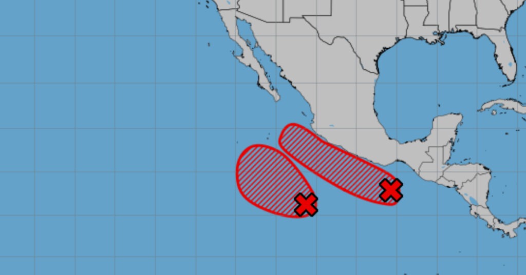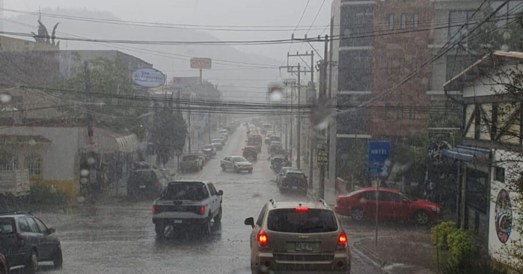

On May 23, 2025, widespread heavy rains and potential flooding will hit northern, central and southern Mexico, while a heat wave pushes daytime highs to 45 °C—stay prepared.
A pronounced dry line over northern Mexico, interacting with multiple low-pressure channels across the Central and Southern Plateaus, is drawing abundant moisture from the Pacific Ocean, Gulf of Mexico and Caribbean Sea. Combined with marked atmospheric instability, this setup will trigger widespread rainfall—from showers to intense downpours—across much of the country today. Meanwhile, a vigorous heat wave will persist in many western, central and southern states, driving daytime highs into the low-to-mid 40 °C range.
Rainfall Forecast
- Intense rains (75–150 mm): Oaxaca and Chiapas
- Very heavy rains (50–75 mm): Michoacán and Guerrero
- Heavy showers (25–50 mm): San Luis Potosí; Jalisco; State of Mexico; Mexico City; Morelos; Puebla; Tlaxcala; Hidalgo; southern Veracruz
- Showers (5–25 mm): Chihuahua; Coahuila; Nuevo León; Durango; Zacatecas; Aguascalientes; Colima; Guanajuato; Querétaro; Tamaulipas; Tabasco; Campeche; Yucatán; Quintana Roo
- Isolated showers (0.1–5 mm): Nayarit
Expect frequent lightning and hail in heavier cells. Flooding, urban ponding, landslides and rising rivers/streams are possible, especially in mountainous and coastal foothill areas.
Temperatures
- Max 40–45 °C: Baja California; Sonora; Sinaloa; Chihuahua; Coahuila; Nuevo León; San Luis Potosí; northern Chiapas; southern Veracruz; Tabasco; Campeche; Yucatán
- Max 35–40 °C: Baja California Sur; Durango; Zacatecas; Nayarit; Jalisco; Colima; Michoacán; Querétaro; Hidalgo; Morelos; Puebla; southwest State of Mexico; Guerrero; Oaxaca; Tamaulipas; Quintana Roo
- Max 30–35 °C: Aguascalientes; Guanajuato
Morning lows will be chilly in high elevations—down to –5 °C in Durango’s mountains, and 0–5 °C in Chihuahua’s high terrain.
Wind & Wave Conditions
- Northern Interior (BC, Chih., Coah., Dur., Zac.): NW winds 20–30 km/h, gusts 50–70 km/h; possible dust storms.
- Widespread (NL, SLP, Ags., Nay., Jal., Mich., Gto., Qro., Hgo., Pue., Tlax., Mor., Gro., Oax., Chis., Tam., Tab., Camp., Yuc., Q Roo): E–SW winds 10–20 km/h, gusts 40–60 km/h; dust storms possible in Sonora, Sinaloa, Baja Sur.
- Coastal waves: 2–3 m heights off Baja’s Pacific coast and along Jalisco–Chiapas shoreline.
Strong gusts may bring down trees, power lines and signage, while elevated winds heighten wildfire danger in dry inland areas.
Regional Highlights
- Mexico City & State of Mexico
Morning fog and cool clouds give way to hot afternoons. Heavy showers—especially over higher ground—will be accompanied by lightning and hail, risking localized flooding and landslides. Lows: 12–14 °C in CDMX; 8–10 °C in Toluca. Highs: 28–30 °C in CDMX; 23–25 °C in Toluca. Winds variable at 10–20 km/h, gusting to 50 km/h. - Baja California Peninsula
Morning fog along the Pacific coast; otherwise dry with rising heat. ENE winds 20–30 km/h, gusting 70 km/h in BC (dust storms possible); lighter winds in Baja Sur. Coastal waves 2–3 m. - Pacific Coast (Sonora–Sinaloa, Michoacán–Colima, Guerrero–Chiapas)
No rain in Sonora/Sinaloa, but a heat wave in Sinaloa. Central Pacific sees heavy afternoon showers in Michoacán and Jalisco; scattered storms in Colima and northern Nayarit. South Pacific endures intense to very heavy rain, especially in Oaxaca, Chiapas and Guerrero—watch for flash flooding and landslides. Afternoon heat waves persist in coastal plains. - Gulf & Yucatán
Clouds and fog in the morning give way to showers in Tamaulipas, Tabasco and Yucatán Peninsula states—locally heavy with hail risk. Afternoon highs reach 40 °C in Tabasco and Campeche. Easterly breezes 10–20 km/h, gusting to 60 km/h. - Northern Tablelands & Central Mesa
Morning fog in San Luis Potosí; cool elsewhere with frost in Durango’s highlands. Heavy afternoon storms in SLP, Morelos, Tlaxcala, Puebla and Hidalgo; scattered showers through the Plateau. Hot, gusty conditions prevail, with dust in arid zones.
Observations (May 22, 2025)
- Max rainfall (24 h): Arriaga (Chis.) 43 mm; Uruapan (Mich.) 34 mm; Villa de Allende (Mex. State) & Loma Grande (Ver.) 15 mm.
- Max temps: Hermosillo 43.0 °C; La Paz & Campeche 41.0 °C; Torreón 40.9 °C; Tacubaya (CDMX) 30.6 °C.
- Min temps: Toluca 10.1 °C; Pachuca 13.4 °C; Tlaxcala 14.2 °C; Mexico City Airport 15.0 °C; San Cristóbal (Chis.) 15.5 °C.
Stay alert for sudden storm developments and heed all local advisories regarding flooding, landslides and wind hazards.