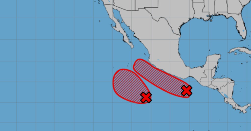
The Coordinación Estatal de Protección Civil y Gestión de Riesgos (CEPCyGR) announced on June 5, 2025, that the rainy season will persist across most of Oaxaca on Thursday, with the highest precipitation totals forecast for the Istmo de Tehuantepec, Sierra Sur, Costa, and Valles Centrales regions. According to meteorological data, moist air currents from the Gulf of Mexico will combine with low-pressure systems to generate localized thunderstorms, accompanied by frequent lightning and gusty winds.
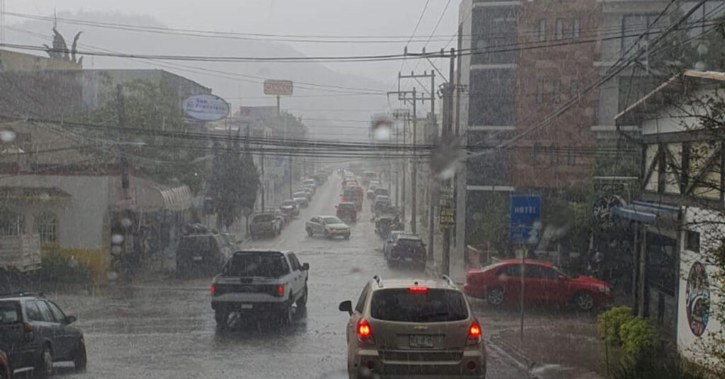
Residents are advised to take precautions in flood-prone areas, as CEPCyGR expects accumulations exceeding 50 millimeters in the coastal plain, with pockets of even higher rainfall in mountainous zones. Public safety officials warned of potential landslides on steep slopes and urged drivers to reduce speed on slick, winding roads. “Stay alert for falling rocks and sudden water buildup in underpasses,” said a CEPCyGR spokesperson. Citizens should also verify that roof gutters and drainage channels near their homes remain clear of debris.
Municipal authorities have dispatched inspection teams to critical points along major highways to monitor river levels and verify the structural integrity of bridges. Several rural communities have initiated sandbagging efforts in low-lying neighborhoods to mitigate flash floods. Meanwhile, the Oaxaca Water Commission cautioned residents to conserve potable water, as heavy rains can raise turbidity levels in reservoirs, complicating treatment processes.
State health services are on high alert for potential increases in mosquito-borne illnesses such as dengue and chikungunya, which flourish in water-stagnant conditions post-rain. Clinics in Valles Centrales have ramped up community outreach programs to educate the public on eliminating breeding sites. “Prompt removal of standing water from flower pots, discarded tires, and open containers is essential to break mosquito life cycles,” health officials advised.