


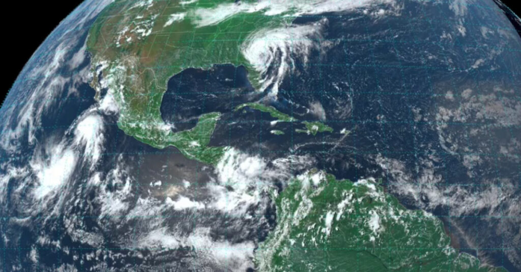
In a rare and complex meteorological phenomenon, Mexico is currently witnessing the Fujiwara effect, where two pairs of storms in the Pacific Ocean are interacting in a unique orbital dance. This century-old concept, first demonstrated by Japanese meteorologist Sakuhei Fujiwara, describes how storms, when close enough (approximately 1,400 kilometers apart), can orbit one another and potentially merge. Depending on their respective strengths and speeds, one storm may absorb the other, or they may simply rotate around a common point before diverging. Presently, this effect is being observed with storms Fabio and Emilia, as well as tropical depressions Daniel and Carlotta, as they influence weather patterns in the region.
Understanding the Fujiwara Effect
Tropical storms Emilia and Fabio form the primary example of the Fujiwara effect currently affecting the Pacific. As both storms spin in the same direction, they are gradually moving towards a common center of rotation. Meanwhile, deeper in the Pacific, tropical depressions Daniel and Carlotta are engaged in a similar interaction. Carlotta, which has recently weakened from a Category 1 hurricane, continues to exert a dominant influence and could potentially absorb Daniel if they converge closely enough, resulting in a single, stronger storm.
Repercussions in Mexico
The Fujiwara effect is contributing to significant rainfall across parts of Mexico. While the interaction of these storms is visually captivating, their immediate effects are largely limited to specific regions due to their distance from the mainland. Tropical Storm Emilia is currently situated 1,135 kilometers southwest of Cabo San Lucas, Baja California Sur, with sustained winds of 100 kilometers per hour and gusts up to 120 kilometers per hour. Despite its strength, its impact will not reach the coast. However, it will complete the Fujiwara effect alongside Tropical Storm Fabio, located 610 kilometers southwest of Cabo San Lucas. Fabio’s gusts of up to 120 kilometers per hour are expected to bring very heavy rain to the states of Nayarit and Jalisco, along with scattered showers in Baja California Sur. Coastal areas can anticipate waves ranging from one to three meters in height.
The low-pressure systems Daniel and Carlotta, positioned nearly 2,000 kilometers from Baja California Sur, are not expected to have any direct impact on Mexico. Nonetheless, the broader meteorological activity in the Pacific, combined with the seasonal Mexican monsoon, is set to generate considerable rainfall across various regions. The Mexican monsoon, a seasonal occurrence characterized by increased cloud cover and precipitation, predominantly affects the Sierra Madre Occidental region. Coupled with atmospheric instability at high altitudes, this will result in intense rainfall accompanied by hail in Sonora, Sinaloa, and Chihuahua, while Durango will experience heavy rains and Baja California will see scattered showers. All of these regions will also face electrical discharges and strong winds.
Other low-pressure channels, one extending along the Sierra Madre Occidental to the west and center of the country, and another spreading across the southeastern regions, are interacting with humid air masses from the Caribbean Sea, the Gulf of Mexico, and the Pacific Ocean. This combination is forecast to produce very heavy rains in Guerrero, Michoacán, Chiapas, Oaxaca, Colima, the State of Mexico, Mexico City, Morelos, Veracruz, and Puebla, as well as moderate showers in Zacatecas, Guanajuato, Tlaxcala, Hidalgo, Querétaro, Campeche, Yucatán, and Quintana Roo.
Historical Context and Notable Cases
The Fujiwara effect is most frequently observed during hurricane and typhoon seasons, particularly in the northwestern Pacific. Among the most notable recent instances was in 2017 when Typhoon Noru, one of the strongest storms of the year, absorbed Tropical Storm Kulap near the coast of Japan. Another significant event occurred in 1995, when four meteorological systems—Humberto, Iris, Karen, and Luis—formed in the Pacific. In that case, Hurricane Iris ultimately absorbed Tropical Storm Karen, exemplifying the dynamic interactions that can occur between closely aligned storm systems.