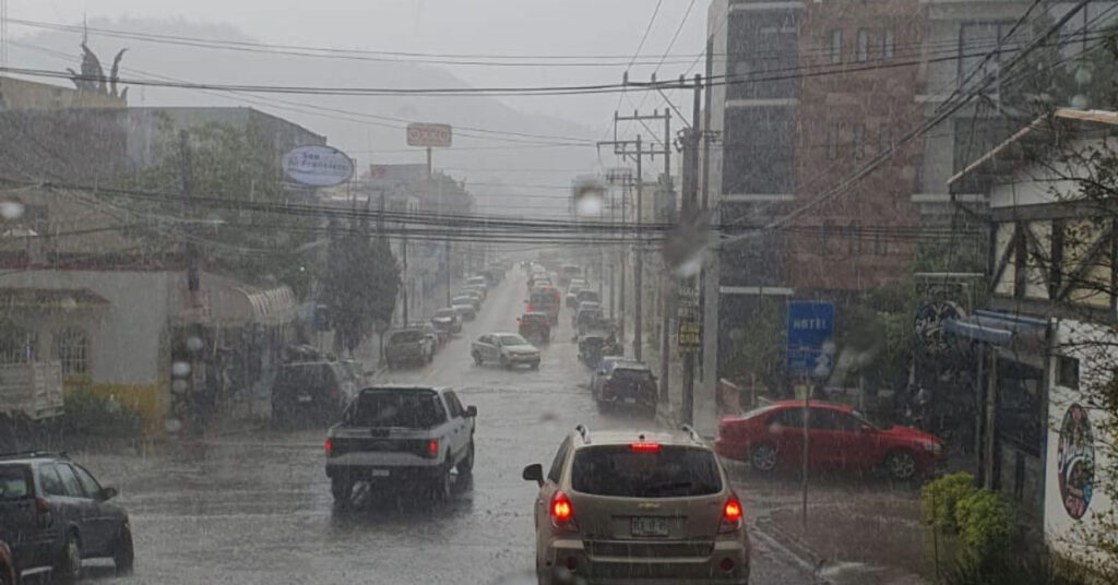

During Monday, July 22, a combination of meteorological phenomena including the Mexican monsoon, two tropical waves, low-pressure systems, a nearby frontal system, and upper-level divergence will significantly impact weather conditions across much of Mexico. The forecast predicts heavy to very heavy rainfall, strong winds, and possible whirlwinds, with the potential for electrical storms and hail. This weather may lead to increased river and stream levels, landslides, flooding, and other hazardous conditions.
Detailed Weather Systems and Effects:
- Mexican Monsoon:
- Region: Northwest Mexico
- Effects: Heavy to very heavy rains, electrical discharges, gusty winds, possible hail, and showers in the Baja California Peninsula.
- Winds: Strong winds with possible whirlwinds in Sonora.
- Low Pressure Channels and Frontal System:
- Region: North and Northeast Mexico
- Effects: Showers, heavy rains, electrical discharges, possible hail, and strong to very strong winds with whirlwinds in Chihuahua, Coahuila, Nuevo León, and Tamaulipas.
- Humidity: Increased due to moisture from both coasts.
- Tropical Wave No. 12:
- Region: West and Center Mexico
- Effects: Heavy to very heavy rains, particularly in Jalisco, Colima, Michoacán, Guerrero, and the State of Mexico, including the Valley of Mexico.
- Cyclonic Development: Low-pressure zone south of Guerrero and Michoacán.
- Tropical Wave No. 13:
- Region: Yucatán Peninsula and Southeast Mexico
- Effects: Heavy to very heavy rains, with intense rains in Chiapas.
- High Temperatures:
- Region: Northwest, North, Northeast Mexico, and Yucatán Peninsula
- Temperatures: Above 40°C in Baja California and Sonora.
24-Hour Forecast (July 22-23):
- Intense Rains (75 to 150 mm): Coahuila, Nayarit, Jalisco, Colima, Michoacán, Guerrero, State of Mexico, Puebla, Veracruz, Oaxaca, and Chiapas.
- Heavy Rains (50 to 75 mm): Sonora, Chihuahua, Nuevo León, Tamaulipas, Durango, Sinaloa, Guanajuato, Mexico City, Morelos, and Tabasco.
- Showers with Heavy Rain (25 to 50 mm): San Luis Potosí, Aguascalientes, Zacatecas, Querétaro, Hidalgo, Tlaxcala, Campeche, Yucatán, and Quintana Roo.
- Showers (5 to 25 mm): Baja California and Baja California Sur.
- Strong Winds (60 to 80 km/h) and Possible Whirlwinds: Sonora, Chihuahua, Coahuila, Nuevo León, and Tamaulipas.
- Gusty Winds (40 to 60 km/h): Various regions including coastal areas of Oaxaca and Guerrero, with possible dust storms in San Luis Potosí.
- High Temperatures (40 to 45 °C): Baja California and Sonora.
- High Temperatures (35 to 40 °C): Baja California Sur, Sinaloa, Coahuila, Nuevo León, Tamaulipas, Campeche, Yucatán, and Quintana Roo.
48-Hour Forecast (July 23-24):
- Mexican Monsoon Continuation:
- Region: Northwest Mexico
- Effects: Heavy to very heavy rains, electrical discharges, gusty winds, possible hail, intense rainfall in Durango and Chihuahua, and showers in the Baja California Peninsula.
- Winds: Strong gusts with possible dust storms in Sonora.
- Low Pressure Channels and Frontal System:
- Region: Northeast and North Mexico
- Effects: Very strong to intense rains, electrical discharges, possible hail, and strong winds with whirlwinds in Coahuila, Nuevo León, and Tamaulipas.
- Tropical Wave No. 12:
- Region: West Mexico
- Effects: Heavy to very heavy rains, electrical discharges, intense rainfall in Michoacán and Guanajuato.
- Low Pressure Channels and Tropical Wave No. 13:
- Region: Center, East, Southeast Mexico, and Yucatán Peninsula
- Effects: Showers, heavy to very heavy rains, intense rainfall in the State of Mexico, Hidalgo, Puebla, Oaxaca, and Veracruz.
- High Temperatures:
- Region: Northwest, North, Northeast Mexico, and Yucatán Peninsula
- Temperatures: Above 40°C in Baja California and Sonora.
Important Notes:
- The forecasted rains may be accompanied by electrical discharges, gusts of wind, and possible hail, potentially causing increased river and stream levels, landslides, puddles, and flooding in low-lying areas.
- Authorities recommend staying informed through official channels, taking necessary precautions, and following any advisories or warnings issued.
Stay safe and prepared as these weather systems move through the country.